Shedding new light on Leichhardt’s expedition
A project by researchers at the ANU National Centre of Biography has shed new light on Ludwig Leichhardt’s landmark expedition to explore northern Australia 170 years ago.
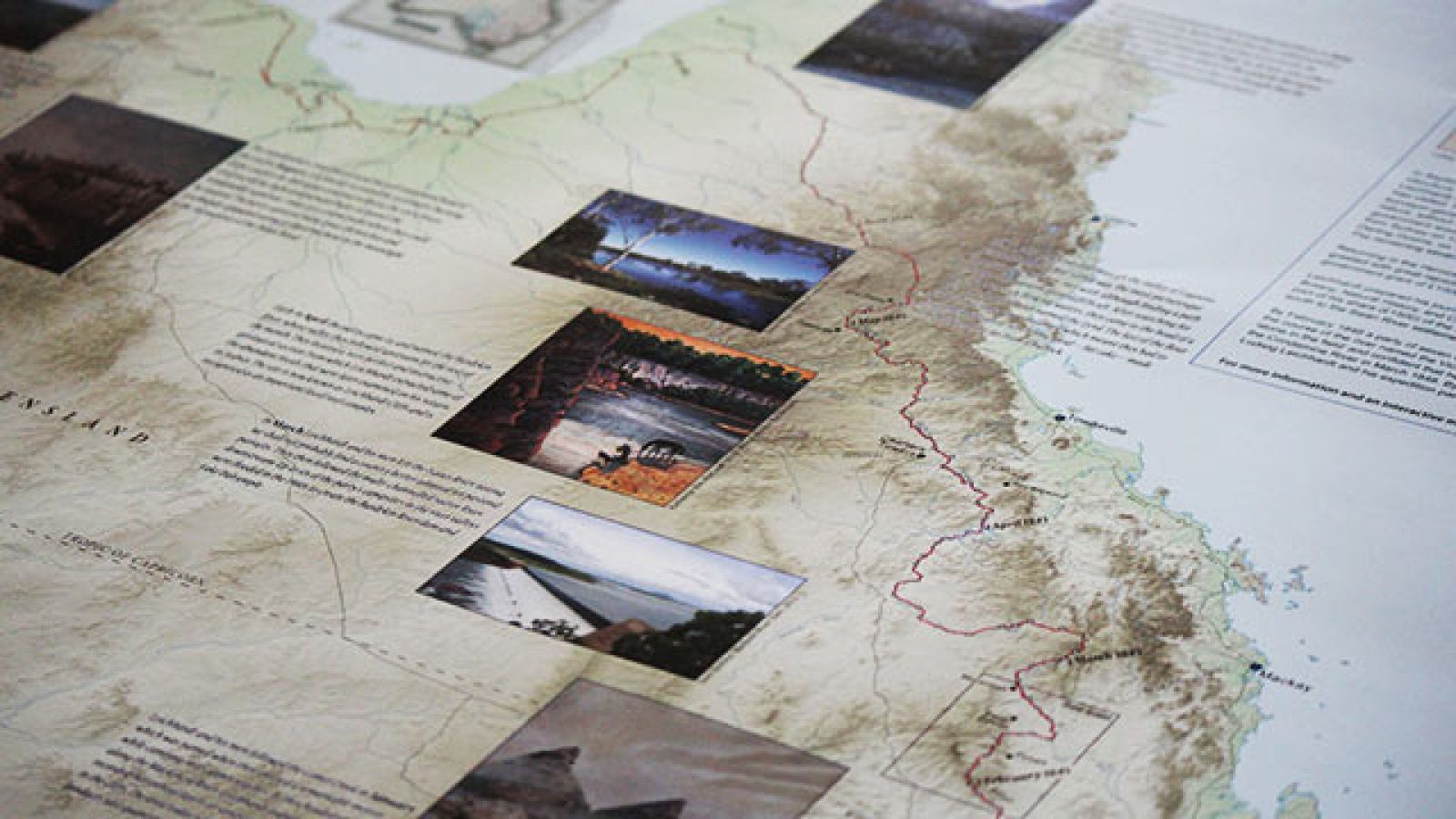
For the first time a new map and a new digital map will detail the exact route taken by Leichhardt on his historic first expedition in 1844 from Moreton Bay in Queensland to Port Essington in the Northern Territory.
ANU Project Manager Christine Fernon said previous maps of the 14-month expedition are, at times, up to 32 kilometres off.
“Our work showed the Leichhardt expedition route was significantly further west than has been documented,” Ms Fernon said.
Leichhardt disappeared in 1848 while leading a second expedition from Moreton Bay to Perth. His disappearance remains a mystery.
Ms Fernon said the original map of the 1844 journey used coordinates recorded by Leichhardt himself that were plotted by renowned English cartographer John Arrowsmith.
“The problem was that many of Leichhardt’s instruments were faulty,” she said.
“He was also being guided by an incomplete map of Australia’s east coast. So there was a lot of educated guesswork. They did pretty darn well, all things considered.”
The new map has been painstakingly assembled by staff of the ANU National Centre of Biography. Researchers retraced the explorer’s steps using modern technology and current satellite maps.
The map includes excerpts from journals kept by Leichhardt and three members of his party, as well as artworks by artists Bill Gannon and Katharine Nix.
An innovative digital version of the map overlaid on Google Maps has been linked to the journals, allowing users to take the expedition online, zooming in on the modern terrain locations of campsites.
“We hope this map is able to give a clearer history for one of Australia’s most well-known explorers,” Ms Fernon said.
The map was formally launched by Chief Scientist Professor Ian Chubb and German Ambassador to Australia HE Dr Christoph Müller at an event at the National Library of Australia on 30 September.
Printed copies of the map are available for purchase via ANU Press